Final Report, Victoria Community Network Association Mapping Project (VCAN)
The Victoria Community Network Association Mapping Project (VCAN) was funded by the City of Victoria’s My Great Neighbourhood Grant (Resilience) program. Thank you to the VCAN Mapping Team for your time and significant contributions to the project. GOMPS provided a letter of support and urban forest expertise via a walking tour for participants.
From March 2024 to March 2025, the project aimed to assess biodiversity distribution within Victoria’s neighbourhoods on private property, complementing the city’s existing tree inventory on public land. The urban area of the City of Victoria is the Garry oak ecosystem (GOE)–– a fact often left out of discussions on the urban forest.
Project Objectives:
– Enhance awareness of cultural ties to the territory and the effects of settlement.
– Foster connections between residents and the urban natural environment.
– Develop a more complete map of Garry oaks and biodiversity elements.
– Identify wildlife corridors for organism movement between complex ecosystems.
– Assist in protecting and restoring the function of sensitive ecosystems and natural areas, including habitat corridors and assist with the parks acquisition strategy (9.2 of the Official Community Plan).
The project’s outcomes aim to inform ecological and cultural restoration, urban development, park acquisition, and canopy equity initiatives.
Phase 1 Highlights:
– Development of an interactive web map accessible and editable by community members.
– Creation of tutorials for mapping significant areas.
– Organization and conversion of data for analytical purposes.
– Preliminary habitat analysis for statistical assessment.
The VCAN Mapping Team also initiated a letter for discussions with builders and developers to address land use changes impacting the Garry oak ecosystem and consider planting native plants and trees as a tangible act of connecting with the territory.
This project serves as a catalyst for dialogue to foster cultural and ecosystem awareness, ultimately promoting a healthier urban canopy and ecosystem through collaborative efforts.
Final report:
VCAN Community Mapping Project (.pdf) (March 2025)
Project Documents
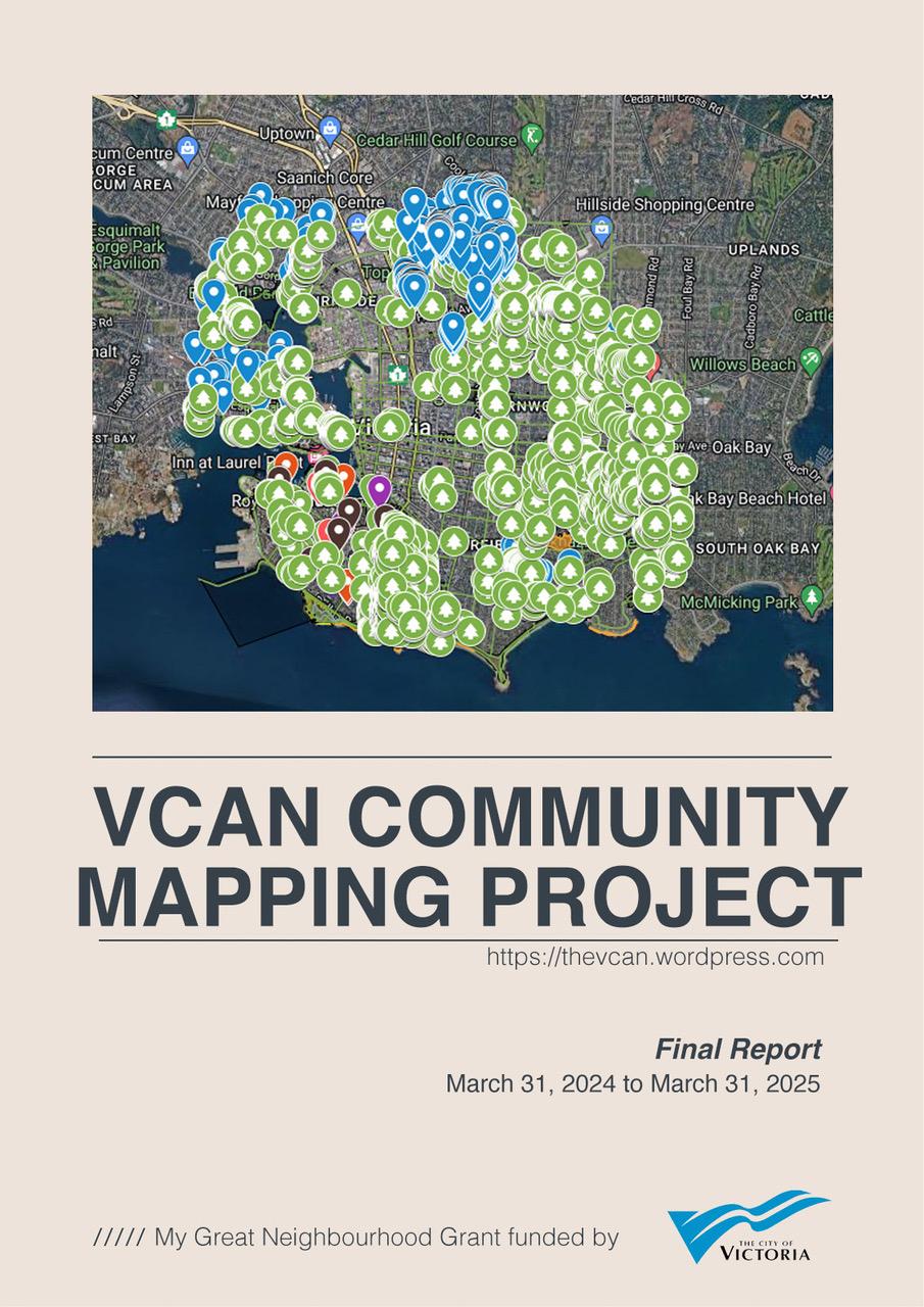
Zoom to enlarge areas on the map. The City of Victoria Garry oak tree inventory data is noted in green. Other points represent individual trees or areas where Garry oaks exist. Please note, this is not an individual Garry oak tree count and does not represent all Garry oak trees in the City of Victoria. Neighbourhoods participating in this community building project included Burnside Gorge, Downtown, Fairfield / Gonzales, Fernwood, Hillside Quadra, James Bay, North Jubilee, South Jubilee, North Park, Oaklands, Rockland, Victoria West.
Presentation Slides
Presentation slides by Carollyne Yardley (.pdf) (Rockland Neighbourhood)
Printed slide deck at wrap-up event by Jacklyn Jolicoeur(.pdf) (James Bay Neighbourhood)
Mapping Tutorials
VCAN Mapping Tutorial (.pdf) (Cedar Shore Consulting)
Ken Wong’s Organic Maps Tutorial (.pdf) (Hillside/Quadra)
Preliminary Suitable Habitat Analysis
Preliminary statistical analysis of environmental characteristics at mapped Garry Oak Tree locations (.pdf) (Cedar Shore Consulting)
Dear Developer: An Earthly Invitation template (.doc) (March 2025)